

Tech Blog: In partnership with C3S, WEMC’s new product considers spatial and physical criteria for renewable energy sources
WEMC’s technical team have been working hard on the Copernicus Climate Change Service (C3S), a project implemented by the European Centre for Medium-Range Weather Forecasts on behalf of the European Commission. Nathalia Correa Sánchez, a data engineer at WEMC, has given us a rundown of what the team have been up to!
…
An effective shift towards achieving the EU’s zero-carbon target by 2050 requires accurate information to enable researchers, energy stakeholders, and governments to develop and implement energy alternatives. In this way, efforts can be optimized, and precise solutions can be found to achieve sustainable development for humanity.
Although the use of a renewable source depends mainly on the availability of resources, other factors affect the viability of wind energy systems. Among them, discerning which are suitable sites for this type of electricity generation is essential. It considers the possible effects of the environmental conditions of the surroundings or the technical incompatibilities for this type of electricity generation.
Scientific articles, with valuable information, have previously described the criteria and methods for identifying the most feasible sites for wind power generation. Based on these, various environmental characteristics are often used to classify territories according to the constraints they may present for large-scale energy use. In practice, these constraints decrease the energy potential of a region, but they also yield more accurate estimates that feed into more effective regional/national energy planning and policy setting.
As part of the Copernicus Climate Change Service (C3S) Energy service, at WEMC, we have used different sources and methods to create a product that considers spatial and physical criteria to represent restricted areas for wind generation. These are:
- Protected areas
- Topographic conditions with high elevations and high slopes
- Areas of urban coverage
- Polar areas
- Offshore regions outside the exclusive economic zone
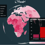
This product is relatively time-invariant and consists of binary layers, with a spatial resolution of 0.25 x 0.25 degrees latitude/longitude and global coverage. This description is illustrated in the map below. This map highlights in red the presence of one or more of these restrictions over a specific area.

This product will be made available in the C3S Data Store. It will be advantageous to refine energy generation estimates based on actual available areas and thus improve our planning and capacity to adapt to climate change.
The multi-variable data the C3S energy project produced is helpful to anticipate important climate-driven changes in the energy sector, and the restricted areas dataset described here will add another useful tool.
…
If you are interested in learning more about WEMC or C3S we’d love to hear from you. Get in touch via info@wemcouncil.org.
For career opportunities with WEMC, please click here. To keep up to date with WEMCs events and news, please subscribe to the WEMC newsletter and follow us on Twitter, LinkedIn, and YouTube.

